
LiDAR use with unmanned vehicles has become an enormously powerful tool for a wide variety of applications including Oil & Gas, Construction, Surveying, and more. Our customers have been flying LiDAR sensors on our aircraft for years, allowing them to capture precise and accurate data with ease.
Looking For Ready-To-Fly LiDAR?
Our main focus is creating the highest performance, most reliable, and easy to use aircraft as possible. While our expertise is not necessarily in the field of LiDAR, we have teamed up with the pros at Phoenix LiDAR Systems to provide users with the best LiDAR experience possible. Their LiDAR systems work with both our PRISM and MFD 5000 aircraft, allowing customers to easily attach both their Ranger and Mini Ranger systems onto our drones with minimal integration. If you are looking for a ready-to-fly LiDAR package, please contact Phoenix LiDAR Systems directly so they can assist you with more information, a quotation, all necessary components and the training to fly LiDAR on our aircraft.
Ready To Handle a Wide Variety of Sensors
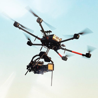
Ranger
The RANGER LR is the Long Range system configuration of the RANGER Series. Designed for the most demanding mapping applications, the RANGER LR features a powerful 1,350 nm laser that penetrates dense vegetation at high speeds and altitudes in large scan regions.
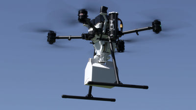
Mini Ranger
This system features an impressive recommended AGL of up to 75 meters, filling a major AGL gap in the lightweight UAV LiDAR market. With the photogrammetry package, operators of mid-size multirotors like PRISM can now simultaneously acquire survey-grade LiDAR data and high resolution 42 MP RTK photogrammetry at up to 100m operating flight altitude.
Teaming with
Phoenix LiDAR Systems
Their expert team will get you properly configured with the sensor that fits your particular needs. If you are looking for a ready-to-fly LiDAR package, please contact Phoenix LiDAR Systems directly for more information.